The Açores Geopark: Portugal's Nine-Island UNESCO Network
What is the Açores Geopark?
The Açores Geopark is a UNESCO Global Geopark covering all nine islands, linking dozens of volcanic craters, lava caves and coastal formations under one scientific management label rather than a single fenced site. It doesn't replace guides to individual landmarks like Sete Cidades or Algar do Carvão — it explains why they exist and how they connect across the whole archipelago, including islands with almost no tourist infrastructure like Corvo and Graciosa.
A Network, Not a Fenced-Off Park
Say the word “geopark” to most visitors and they picture a single reserve with a gate, a car park and an entrance kiosk. The Açores Geopark is nothing like that. It is a UNESCO Global Geopark designation covering the entire archipelago — all nine islands, from São Miguel in the east to Corvo in the far west — awarded in recognition of a shared volcanic origin rather than one bounded piece of land. There is no single address for it, no ticket office, no fence. What exists instead is a network of dozens of individual geosites, scattered across three island groups and hundreds of kilometres of open Atlantic, tied together by a common scientific framework and a shared management structure.
This distinction matters more than it might seem. A traveller planning “a day at the geopark” the way they might plan a day at Furnas or Sete Cidades will end up disappointed, because there is no such day trip. What you can do is visit individual geosites — a crater here, a lava cave there, a stretch of volcanic coastline somewhere else — understanding that each one is a node in a larger, archipelago-wide story about how these nine islands rose from the seafloor. This guide is about that bigger picture: how the label works, which islands and geosites it covers, and how to plan a trip around it without expecting a single, visitable “park.”
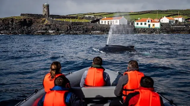
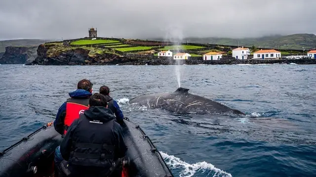
For the geosites themselves in detail — what they look like, how to get in, what they cost — this guide points you onward to dedicated pages: Azores Volcanoes and Craters, the Sete Cidades Crater Guide, the Algar do Carvão Guide and the Furna do Enxofre Guide. Wildlife that shares these landscapes — seabirds nesting on crater cliffs, whales passing offshore — belongs to its own subject, covered in Birdwatching in the Azores and Whale Watching in the Azores.
Three Plates, One Archipelago
The reason a geopark label makes sense here at all comes down to plate tectonics. The Azores sit almost exactly on the junction of three tectonic plates — the North American, Eurasian and Nubian (African) plates — a geologically rare position that has produced an unusually dense concentration of volcanic features for such a small landmass. Every one of the nine islands is a volcanic edifice, built up over the last few million years by eruptions, some long extinct, some as recent as living memory.
That shared origin explains the family resemblance running through Geopark sites on islands that otherwise feel very different from one another: the crater lakes of São Miguel and the crater of Corvo are geological cousins; the lava tube at Algar do Carvão on Terceira and the Furna do Enxofre cave on Graciosa formed by the same basic mechanism, molten rock draining out from beneath a solidifying crust; the hot springs of Furnas and the fumaroles inside Graciosa’s cave both trace back to the same subterranean heat. The Geopark’s job, in essence, is to make these connections visible and to manage the sites responsibly, rather than to fence off a single scenic highlight.
The most recent chapter in that story is legible above ground, too: the Capelinhos volcano on Faial was born in a submarine eruption in 1957–1958, adding new land to the island in real time and burying a lighthouse in ash — a geosite young enough that people who watched it happen are still alive to describe it. Details on that eruption and its interpretive centre are in the Capelinhos Volcano Guide.
What the Geopark Actually Groups Together
Geosites within the network fall into a handful of recurring categories, and it helps to think in those categories rather than trying to see every single one.
Volcanic craters and calderas. The classic Azorean crater lake — a collapsed or explosion-formed basin now filled with water — appears across the islands in different forms, from the twin lakes of Sete Cidades to the crater of Corvo. The Azores Volcanoes and Craters guide is the place to see the full picture; the Sete Cidades Crater Guide covers the archipelago’s best-known example.
Lava caves and tubes. Formed when the outer skin of a lava flow cools and solidifies while molten rock continues draining out beneath it, leaving a hollow tunnel behind. Terceira’s Algar do Carvão and Graciosa’s Furna do Enxofre — the largest volcanic cave of its kind in Europe, complete with an underground lake and active sulphur fumaroles — are the two headline examples, but they are not the only ones; the Azores Lava Caves Guide rounds up the network.
Coastal and marine geoformations. Cliffs, islets and platforms shaped by the meeting of lava and ocean, including the fajãs of São Jorge — flat coastal shelves created by lava flows or landslides, unique to that island and covered in their own right in São Jorge Fajãs Hikes.
Thermal and hydrothermal features. Hot springs, fumaroles and steam vents are the visible surface expression of the same heat source that drives the archipelago’s volcanism, from the bathing pools of Furnas to the sulphur vents inside the Graciosa cave.
The Pico Island vineyard landscape belongs to this story too, though its UNESCO recognition sits under a separate programme — its currais, small vine plots walled in with lava stone, were built directly on volcanic rock because it was the only way to farm the terrain; see Pico Wine and UNESCO Vineyards for how that connects.
Island by Island: A Quick Orientation
No single itinerary covers the whole network — distances between islands are too large and inter-island transport too seasonal for that (see the section on logistics below). What follows is a starting point for matching islands to their geological highlights.
| Island | Group | Signature geological feature | Access difficulty |
|---|---|---|---|
| São Miguel | Eastern | Crater lakes, hot springs, active fumaroles | Easy — daily flights, full road network |
| Santa Maria | Eastern | Oldest island geologically, reddish Barreiro da Faneca badlands | Easy — short flight from São Miguel |
| Terceira | Central | Algar do Carvão lava tube, Monte Brasil volcanic cone | Easy — direct flights, ferries in season |
| Graciosa | Central | Furna do Enxofre cave, caldera rim | Moderate — limited flights, few visitor services |
| São Jorge | Central | Coastal fajãs formed by lava and landslides | Moderate — daily ferry within the Triangle |
| Pico | Central | Portugal’s highest peak, lava-built vineyard walls | Moderate — permit required for the summit |
| Faial | Central | Capelinhos volcano (1957–1958), Caldeira do Faial | Easy — ferry hub of the Triangle |
| Flores | Western | Crater lakes and waterfalls fed by volcanic terrain | Moderate — flights weather-dependent |
| Corvo | Western | Caldeirão crater, smallest inhabited Azorean island | Difficult — the archipelago’s most fragile air and sea links |
For deeper island-level planning, the destination pages for Pico, Faial, São Jorge, Flores and Graciosa go further than this table can, and Which Azores Island to Visit helps prioritise if you can’t reach all nine.
Visiting the Geosites: Guided, Self-Drive or a Mix of Both
Because the Geopark is a label rather than a place, “visiting” it in practice means stringing together individual geosite visits, and the right approach differs by site. Some — crater viewpoints, coastal lookouts — are simple self-drive stops with a short walk from the car park. Others come with real constraints: the Algar do Carvão lava tube has fixed opening hours and an entrance fee; the ascent of Montanha do Pico requires advance registration, a quota-limited permit and a GPS tracker issued at the Casa da Montanha; the Furna do Enxofre cave on Graciosa is normally seen with a guide as part of a small group, not independently.
A guided approach removes most of that friction and adds context a self-guided visit misses — how a fajã actually formed, why a caldera collapsed rather than exploded, what the fumarole gases are made of. On São Miguel, a guided walk around the Sete Cidades crater with a local guide is a straightforward way to see the archipelago’s best-known volcanic basin properly explained rather than just photographed from the rim.
For a route that ties together thermal springs and volcanic terrain in one outing, a guided hike through Janela do Inferno and Caldeira Velha covers hot-spring geology alongside the hike itself. Travellers who want a longer walk through lava-shaped valleys and waterfalls can look at a guided hiking route through the Salto do Prego and Sanguinho valleys, which crosses terrain carved by the same volcanic processes covered on this page.
On Pico, a full-day guided tour of the island is a practical way to see the vineyard landscape, the lava-built currais and the base of the Montanha do Pico climb in one trip without self-navigating unfamiliar roads. And because geosite access rules vary so much from island to island, working with a certified local guide for a day is often the fastest way to understand which sites need a permit, which need a booking, and which are simply a short walk from the road.
Graciosa and Corvo: The Geopark’s Quietest Corners
If one thing separates the Geopark label from a typical tourist trail, it’s that the network deliberately includes islands most visitors never reach. Graciosa and Corvo are both recognised UNESCO Biosphere Reserves in addition to sitting inside the Geopark network — a separate UNESCO programme focused on environmental management, not to be confused with the Geopark label itself or with the World Heritage status held by Pico’s vineyards and Angra do Heroísmo’s historic centre. These are three distinct UNESCO designations covering overlapping ground, and it is worth keeping them apart rather than treating “UNESCO” as one undifferentiated stamp of approval.
Graciosa’s Furna do Enxofre, the largest volcanic cave of its kind in Europe, complete with an underground lake and active sulphur fumaroles, is arguably one of the single most significant geosites in the whole network, yet the island has the least tourist infrastructure of the central group and, as of 2026-09-08, no bookable GetYourGuide activities at all — visits are arranged locally, typically through accommodation or a small local operator.
Corvo, the smallest inhabited island in the archipelago, is dominated almost entirely by the Caldeirão crater and has the most fragile air and sea links of anywhere in the Azores; a visit here is as much a logistical exercise as a geological one, and is usually planned as a day trip from Flores rather than a stay in its own right — see Day Trip to Corvo from Flores for how that works in practice.
Planning Around the Label, Not the Map
Because Geopark sites span nine islands with inconsistent inter-island transport — reliable, near-daily ferries only within the central “Triangle” of Pico, Faial and São Jorge, more limited seasonal links elsewhere, and flights that vary by route and season — no single trip realistically covers the whole network. It helps to pick two or three islands, understand their specific geosites in advance, and build the rest of the itinerary around getting between them reliably.
Getting to the Azores and Inter-Island Ferries Azores cover those constraints in detail, and Azores Island Hopping Guide is a good starting point for sequencing a multi-island route around geological highlights rather than random stops.
Weather is worth building slack into as well. The Azores’ fast-moving Atlantic fronts mean skies can shift from clear to overcast within a few hours on any island, which affects crater-rim views and coastal geosites more than most other attractions — plan flexible days rather than a single fixed date for your best viewpoint, and check Best Time to Visit the Azores before locking in a route. For a longer, hiking-focused approach to the volcanic landscape across multiple islands, Azores Hiking Week sequences several geosite-adjacent trails into a single week.
Treated this way — as a scientific framework linking sites rather than a single destination — the Açores Geopark becomes less a box to tick and more a lens for the whole trip: once you know why a caldera collapsed, why a cave has no roof, or why a stretch of coastline sits flat against cliffs on either side, the rest of the archipelago’s landscape reads differently, island by island, all the way from São Miguel to Corvo.
Açores Geopark: Frequently Asked Questions
What is the Açores Geopark, exactly?
It is a UNESCO Global Geopark, a management and education label awarded to the entire Azores archipelago in recognition of its volcanic geology. It groups dozens of individual geosites across all nine islands under one scientific network rather than describing a single park with a gate and an entrance fee.
Is the Geopark a single place you can visit?
No. There is no single Açores Geopark site to walk into. The label covers the whole archipelago, and the geosites within it — craters, calderas, lava caves, coastal cliffs — are scattered across all nine islands, each with its own access, opening hours and, in some cases, entrance fee.
Which islands are part of the Açores Geopark?
All nine: São Miguel, Santa Maria, Terceira, Graciosa, São Jorge, Pico, Faial, Flores and Corvo. Even the least-visited islands, Corvo and Graciosa, hold geosites of global significance, such as Corvo’s Caldeirão crater and Graciosa’s Furna do Enxofre.
What is a UNESCO Global Geopark, and how is it different from a national or natural park?
A UNESCO Global Geopark is a management network built around geological heritage, science communication and community involvement, not a protected area with fixed boundaries and a single management authority. A natural park typically has a defined perimeter and one governing body; a geopark can span nine islands and hundreds of kilometres of ocean, as it does here.
Do all nine islands have visitor centres or marked geosites?
Most have at least one interpretive site or marked trail, but provision is uneven. São Miguel, Terceira and Pico have the most developed infrastructure; Corvo and Graciosa have far fewer facilities, and some of their geosites are best reached with a local guide rather than independently.
Can I visit Geopark sites on Graciosa without a tour operator?
Some, yes — the windmills and the caldera rim are accessible by rental car. The Furna do Enxofre cave, however, has restricted access and is normally visited as part of an organised group with a local guide, and as of 2026-09-08 there are no Graciosa activities bookable through GetYourGuide, so arrangements are made locally or through your accommodation.
What’s the difference between the Geopark label and UNESCO World Heritage status?
They are separate UNESCO programmes with separate criteria. World Heritage status, held locally by the Pico Island vineyard landscape and the historic centre of Angra do Heroísmo, recognises outstanding cultural or natural value at a specific site. The Global Geopark label recognises a territory’s geological heritage and how it is managed and interpreted for visitors and residents alike.
Do I need a guide to visit the geosites?
Not for every site — many craters and coastal viewpoints are reachable by rental car and a short walk. But several of the most striking geosites, including lava caves and the summit of Montanha do Pico, require a permit, a guide, or both, so check access rules for each site individually before planning your day.
tours.wildlife-nature
Verified deep-linked GetYourGuide tours. Book through these links and we earn a small commission at no cost to you.
GetYourGuide does not provide a product photo for this activity — the image shows the meeting point, photographed by us.