The Best Hikes in the Azores, Island by Island
Which Azores island is best for hiking?
São Miguel has the largest trail network (crater rims, Lagoa do Fogo, Sete Cidades), Flores is the pick for waterfalls and lake trails, and São Jorge is unmatched for fajã descents. Pico's summit trail is a separate, permit-only climb, not a casual hike.
Choosing an Island Before You Choose a Trail
Nine volcanic islands scattered across roughly 600 km of Atlantic Ocean means hiking in the Azores is really nine separate decisions, not one. Inter-island flights and ferries are limited enough — the reliable “Triangle” of Pico, Faial and São Jorge aside — that most visitors end up walking on whichever one or two islands they actually book, not the ones with the single best trail. This page is a starting filter: which island rewards a hiking-focused trip, what kind of terrain to expect there, and where to go for the island-by-island detail once you’ve picked.
Two things this page deliberately does not do. It does not repeat the trail-by-trail breakdowns already covered for São Miguel, São Jorge’s fajãs, Flores or the Salto do Prego waterfall trail — follow those links once you know your island.
And it does not treat the ascent of Mount Pico as an item on a hiking list, because it isn’t one: it is a permit-controlled climb with a daily quota, a mandatory GPS tracker issued at the Casa da Montanha, and fees that scale with how far up the crater you go. Grouping it alongside a two-hour coastal loop would badly undersell what it actually takes to attempt it.
The Islands Compared
| Island | Terrain | Best for | Typical difficulty |
|---|---|---|---|
| São Miguel | Crater lakes, thermal valley, sea cliffs | Widest choice, short trips | Easy to moderate |
| São Jorge | Fajãs reached by steep zig-zag descents | Dramatic single-day routes | Moderate to hard |
| Flores | Waterfalls, crater lakes, cliff paths | Scenery-per-kilometre | Easy to moderate |
| Pico (coastal trails) | Lava fields, vineyard currais, coastline | Combining with the summit permit | Easy to moderate |
| Faial | Caldeira rim, coastal paths near Horta | Half-day walks around a base | Easy to moderate |
| Terceira | Volcanic craters, coastal fringe | Short walks between historic sites | Easy |
| Santa Maria | Drier hills, red-earth badlands | A quieter, less-hiked island | Easy to moderate |
Use this table as a first pass only — trail grading on any of these islands can shift with weather in a way a table can’t capture. The system used to grade routes across the archipelago is explained separately in how Azores trail grading works; read it before trusting a “moderate” label at face value, since a moderate coastal trail in dry weather becomes something else entirely in wind and rain.
São Miguel: The Widest Network, the Easiest Logistics
São Miguel is where most Azores trips start, and it’s also the island with the largest concentration of graded trails within a manageable drive of each other. The crater rim above Sete Cidades gives one of the archipelago’s most photographed panoramas — two lakes in a single caldera, one reputedly green and one blue — reachable by several loop options of varying length. Further east, the trail network around Lagoa do Fogo climbs through a nature reserve to a crater lake sitting almost 1,000 metres up, with cloud cover that can close in fast enough to erase the view in minutes.
The thermal valley around Furnas adds a different kind of walking — gentler paths through steaming ground and botanical gardens rather than ridge scrambling — and works well as a lower-effort day between harder hikes elsewhere on the island. A guided half-day route through the Lagoa do Fogo reserve is one of the more established ways to do this safely with local knowledge of where the fog tends to sit:
a half-day guided hike around Lagoa do FogoFor the full breakdown of routes, distances and which trailheads to start from, the dedicated São Miguel hiking trails guide goes island-deep in a way this comparison page won’t.
São Jorge: Walking Down Into the Fajãs
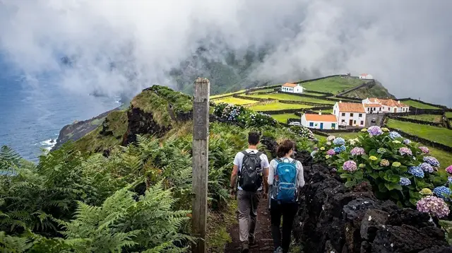
São Jorge earns its reputation the hard way. The island’s defining feature is the fajã — a flat coastal shelf formed by old lava flows or landslides, sitting at the base of near-vertical cliffs that can run several hundred metres high. Reaching one on foot usually means a steep, switchbacking descent (and, on the way back, an equally steep climb), which is a very different proposition from a flat coastal path elsewhere in the archipelago. The best-known example, the Fajã da Caldeira de Santo Cristo, combines the descent with a lagoon known locally for its clams, while Fajã dos Vimes offers a gentler version of the same idea.
This is the island to choose if the goal is one unforgettable, physically demanding day rather than a week of easier options — and it rewards planning trail direction around which descent you’re prepared to climb back out of. The full route list, timing and which fajãs pair well into a single day are covered in São Jorge’s fajã hiking guide; this page only flags it as the island for that specific kind of hike.
Flores: Waterfalls, Crater Lakes, and a Trail That Ends in Water
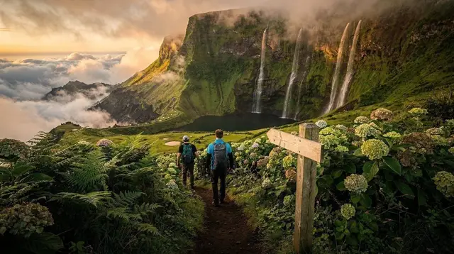
If São Jorge is about descent, Flores is about density of scenery per kilometre walked. Waterfalls drop directly toward the ocean in several places, crater lakes sit in old calderas within a short walk of each other, and the island’s UNESCO biosphere status reflects just how much of it remains close to untouched. The best-known single route, the Salto do Prego, follows a stream down to a waterfall and natural pool that’s swimmable in season — a rare payoff for a moderate walk anywhere in the archipelago.
a guided hike to the Salto do Prego waterfallFlores sits in the western group, whose ferry and flight connections to Corvo and the rest of the archipelago are the least reliable in the Azores — a factor worth weighing before building a tight itinerary around it. For the complete trail list and how to combine them into a multi-day stay, see hiking trails on Flores and, for the Salto do Prego specifically, the dedicated route guide.
Faial and Pico: Caldeira Rims and Coastal Paths — Not the Summit
Faial and Pico sit close enough together, linked by a reliable year-round ferry, that they’re often hiked as a pair. On Faial, the Caldeira do Faial offers a rim walk around a deep, largely intact volcanic crater, while shorter coastal paths near Horta’s marina make for an easy add-on to a day spent exploring the town itself. A local guide can string these into a fuller walking tour around the island’s western half:
a guided walking tour of Faial’s trails around HortaPico has genuine hiking terrain of its own at lower altitude — trails through the UNESCO-listed lava-stone vineyard currais near Criação Velha, and coastal walks near the old whaling port of Lajes do Pico — that are entirely separate from the mountain itself. It bears repeating: the summit trail up Montanha do Pico is not a casual add-on to a Faial-Pico hiking trip.
It requires registering in advance with the Casa da Montanha, carrying an assigned GPS tracker, and paying fees that scale by how far up you go (with an extra refundable-style charge tied to returning the tracker). Treat it as its own booking, covered fully in the climbing Mount Pico guide, and build the rest of a Pico visit around the coastal and vineyard trails instead.
Terceira and Santa Maria: Shorter Walks, Fewer Crowds
Terceira and Santa Maria don’t headline most hiking-focused itineraries, and that’s part of their appeal for a traveller who wants trails without the crowds building around São Miguel’s best-known routes. Terceira’s volcanic interior includes short walks around its craters, easily paired with a day spent around the UNESCO-listed old town, while the island’s coastal fringe adds a handful of easier options. Santa Maria, the archipelago’s oldest and driest island geologically, offers a different colour palette entirely — reddish badland terrain and drier scrubland walks that feel closer to a Mediterranean island than the lush green more typical elsewhere in the Azores.
Neither island should be the sole reason to build a hiking-first trip, but both work well as a lower-key third or fourth stop for someone island-hopping through the central and eastern groups.
Building a Hiking-Focused Azores Itinerary
Because inter-island transport outside the Pico-Faial-São Jorge triangle thins out sharply for much of the year, a hiking-first trip works best when it’s planned around two or three islands rather than an ambitious tour of all nine. A dedicated Azores hiking week itinerary lays out one way to sequence this, and the Pico and Faial in 5 days route is a practical template for pairing those two islands around the reliable ferry link between them.
Whichever islands make the cut, keep the archipelago’s four-seasons-in-a-day weather pattern in mind when scheduling trail days — fog and rain can roll in and clear within the same afternoon, which argues for building flexibility into a plan rather than locking every hike to a fixed date. The month-by-month weather guide breaks down which months tend to be driest, though “tends to” is doing real work in that sentence: no month here comes with a dry-season guarantee the way it might on a neighbouring Atlantic archipelago.
Where Boats and Coastal Walking Meet
Several islands blend hiking with time on the water rather than treating them as separate activities — a coastal trail that ends at a jetty, or a walking day bookended by a boat trip along cliffs that aren’t reachable on foot at all. Coasteering along São Miguel’s coastline is one way to see cliff terrain from the water side instead of the trail side:
a coasteering trip along São Miguel’s coastIt’s worth treating this as a complement to a hiking day rather than a substitute — the two show genuinely different parts of the same coastline.
Frequently Asked Questions About Hiking in the Azores
Which Azores island has the best hiking overall?
São Miguel wins on volume and variety — crater rims, a thermal valley and coastal ridges all within a short drive of each other, plus the easiest transport logistics of any island. Flores and São Jorge are stronger picks if the goal is one exceptional trail rather than a week of varied options.
Is climbing Mount Pico included in this list?
No, deliberately. The Montanha do Pico ascent requires advance registration with the Casa da Montanha, a daily quota on climbers, and a mandatory GPS tracker, with fees that increase depending on how far up the crater you go. That puts it on entirely different footing from the graded trails compared here — see the Mount Pico climbing guide before booking it separately.
Do I need a guide for Azores hiking trails?
Most graded coastal and crater-rim trails on São Miguel, Faial and Terceira are walkable independently with a downloaded map and reasonable fitness. Fajã descents on São Jorge, and any route that climbs above the fog line, are where a local guide earns their fee — both for route-finding and for reading which way the weather is about to turn.
What’s the easiest island for short, scenic hikes?
São Miguel and Faial both offer well-marked loops under two hours with a clear payoff at the end — a crater lake view or a caldera rim — making them the better choice for a single free afternoon slotted between other bookings rather than a full hiking day.
When is the best time to hike in the Azores with the least fog?
Fog can settle on any ridge in any month, but June through September gives the best odds of clear conditions. Even in those months, plan each hike as if the weather could change mid-route — locals describe it as four seasons in a single day, and that applies to trail visibility as much as to rain.
Do Azores hiking tours need to be booked in advance?
Small-group guided hikes on São Miguel and Faial can fill up during July and August, so booking a few days ahead is safer than counting on a same-day slot in peak season. Outside those months, availability is generally easier to find closer to the date.
How does trail difficulty grading work across the islands?
The Azores use a grading approach shared across most official and guided trails, factoring in distance, elevation change and terrain exposure rather than a single simple easy-moderate-hard label. The full system, and how to read it before committing to a route, is explained in the trail grading guide.
tours.hiking-trails
Verified deep-linked GetYourGuide tours. Book through these links and we earn a small commission at no cost to you.
GetYourGuide does not provide a product photo for this activity — the image shows the meeting point, photographed by us.