São Miguel Hiking Trails: The Complete Guide
What are the best hiking trails on São Miguel?
São Miguel's best-known trails circle the Sete Cidades crater rim, climb toward the Lagoa do Fogo from either Ribeira Grande or the Vila Franca do Campo side, and follow the green coastal paths around Nordeste, including the Salto do Prego waterfall trail. These are separate, shorter walks from the ascent of Montanha do Pico, which sits on a different island and requires advance registration.
An island built for walking
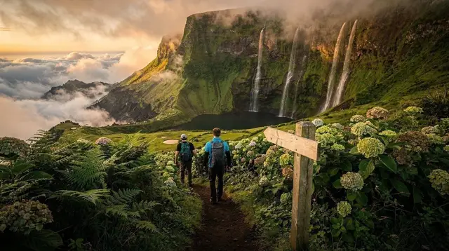
São Miguel packs an unusual range of hiking terrain into one island: a volcanic crater rim in the west, a highland lake ringed by cloud forest in the center, and a network of green coastal paths in the east around Nordeste. None of these routes require the kind of advance registration that governs the ascent of Montanha do Pico on the neighboring island of Pico — that climb sits on a different island entirely, with its own quota system and GPS check-out, and it has no place on a São Miguel hiking itinerary. What follows is a working map of where São Miguel’s trails cluster, what each area actually involves on the ground, and how to choose two or three routes rather than trying to walk the whole island in one visit.
This guide does not repeat the full route description of the Sete Cidades crater rim or the Salto do Prego waterfall walk — both already have dedicated guides linked below — and it does not cover the trails of other islands or the formal grading system used across the wider Azores hiking guide. Its job is narrower: to help someone planning a São Miguel-only trip work out which trails deserve a place in a five- or seven-day itinerary.
Where São Miguel’s trails cluster
Almost every named hiking route on the island falls into one of three clusters, each built around a different kind of volcanic landscape.
The Sete Cidades rim, in the west. A twin-crater lake system — one lake blue, one green in the right light — ringed by a walking trail along the outer edge. Access points sit around the Sete Cidades area, and the crater itself, its miradouros, and the specifics of the rim circuit are covered in full in the Sete Cidades crater guide.
The Lagoa do Fogo highlands, in the center. A crater lake reached only on foot, sitting inside a nature reserve above Ribeira Grande on one side and the hills above Vila Franca do Campo on the other. The lake and its access routes are detailed in the Lagoa do Fogo guide; this page treats it as one of three areas to weigh against the others when planning.
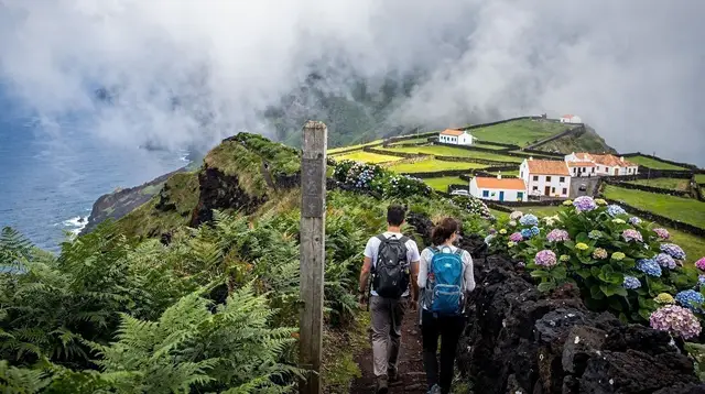
The Nordeste and Furnas coastal-and-forest network, in the east. A denser web of shorter paths through pasture, laurel forest, and steep coastal cliffs around Furnas and Nordeste, including the well-known Salto do Prego waterfall route, whose full details live in its own guide.
A fourth, smaller option worth knowing about: short coastal walks near Vila Franca do Campo, often combined with a boat trip out to the offshore islet, described in the Vila Franca islet guide.
Trail areas at a glance
| Area | Terrain | Typical time | Best suited to |
|---|---|---|---|
| Sete Cidades rim | Crater-edge ridge, exposed to wind | 3–6 hours for longer sections | Views over both crater lakes, photography |
| Lagoa do Fogo (Ribeira Grande side) | Forest track climbing to a viewpoint | 2–3 hours round trip | A shorter half-day walk with a lake payoff |
| Lagoa do Fogo (Vila Franca side) | Steeper ascent through pasture and scrub | 3–4 hours round trip | Hikers wanting more elevation gain |
| Nordeste coastal paths | Mixed pasture, forest, and cliff-edge sections | 1–4 hours depending on route chosen | Combining several short walks in one day |
| Salto do Prego area | Mostly downhill to a waterfall pool | 1–2 hours | A shorter, family-friendly outing |
These durations describe walking time only and leave out driving between trailheads, which on São Miguel is rarely quick — distances look short on a map but the roads are narrow and winding.
Sete Cidades: choosing a section of the rim
Most visitors do not walk the entire Sete Cidades crater rim in one outing; the full loop is a long day. Shorter, well-marked sections start from individual miradouros and can be walked in an hour or two, giving views down onto both lakes without committing to the whole circuit.
Because the crater’s specific viewpoints, the villages inside the caldera, and the practicalities of the rim walk are already covered step by step in the dedicated Sete Cidades crater guide, this page treats Sete Cidades as one item on a shortlist rather than repeating that route detail. For a first visit centered on the west of the island, a half-day built around one or two rim sections plus time down at the lakeside villages tends to work better than attempting the full ridge.
Lagoa do Fogo: two ways up, one lake
Lagoa do Fogo sits inside a protected nature reserve, and unlike Sete Cidades there is no road to the water’s edge — reaching the lake, or at least a close viewpoint above it, means walking. The two main approaches differ enough to matter when planning:
- From the Ribeira Grande side, a forest track climbs gradually to a viewpoint over the lake, generally the shorter and gentler of the two options.
- From the Vila Franca do Campo side, the ascent is steeper and passes through more open pasture and scrub before reaching the ridge above the lake.
Neither route is technical, but both cross exposed, often wet terrain where the “four seasons in one day” pattern common across the Azores applies in full — clear skies at the trailhead can give way to cloud and drizzle by the time a walker reaches the rim. A half-day is realistic for either approach; combining both in one day is possible but makes for a long day given the driving involved between the two ends of the reserve. Full route notes, distances, and viewpoint details sit in the Lagoa do Fogo guide.
For visitors who prefer a guided outing rather than navigating trailhead access alone, a hiking day trip built specifically around the reserve is a practical shortcut:
a guided hiking day around Lagoa do FogoNordeste and Furnas: a network of shorter walks
The eastern end of São Miguel, around Nordeste and Furnas, is where the island’s hiking options are most varied and least concentrated into one signature route. Rather than a single named trail, this area offers a scattered network of pasture paths, forest tracks, and coastal cliff walks, several of which can be strung together into a single day depending on how much driving a visitor is willing to do between trailheads.
The best-known route here is the walk to the Salto do Prego waterfall near Ribeira dos Caldeirões, a mostly downhill path ending at a natural pool — short enough to pair with lunch in Furnas or a stop at the thermal pools nearby. Because its route is already documented step by step, this guide leaves the detail to the Salto do Prego guide and instead flags it as the easiest, most time-efficient walk in the Nordeste cluster for visitors short on hiking days.
Beyond Salto do Prego, the wider Nordeste coastline offers cliff-edge paths with sweeping Atlantic views, generally quieter than Sete Cidades or Lagoa do Fogo simply because Nordeste sits further from Ponta Delgada. These are best treated as a flexible add-on to a Furnas-based day rather than a fixed itinerary — checking current trail conditions locally is worthwhile given how exposed some sections are to coastal weather.
A guided tour that covers Furnas alongside its surrounding countryside is a reasonable way to see the area’s highlights without self-navigating every junction:
a half-day tour through Furnas and its surroundingsWeather, timing, and what to pack
São Miguel’s weather does not follow a simple wet-season, dry-season pattern, and hikers should plan around the island’s habit of shifting from sun to rain and back within a few hours rather than trusting a single morning forecast. Statistically, July and August are the driest months and November through February the wettest, but no month on the island guarantees a rain-free day, and cloud cover at altitude — especially around Lagoa do Fogo — is common even when the coast is clear.
Practical preparation matters more than picking a “perfect” month:
- A waterproof shell and layers, since temperatures and conditions can change abruptly with elevation and cloud cover.
- Footwear with real grip — volcanic soil and wet grass get slick, particularly on the Lagoa do Fogo approaches and the Sete Cidades rim.
- An early start on longer routes, since fog tends to build over the highlands later in the day.
- A charged phone and a downloaded map, since signal is inconsistent on the more remote coastal and highland sections.
For a broader sense of how conditions shift across the year, the weather month by month guide and the general best time to visit guide cover the archipelago-wide picture that applies to São Miguel as well.
Getting to trailheads
Because São Miguel’s trailheads are spread across the island rather than clustered near Ponta Delgada, a rental car is close to essential for reaching more than one or two of them in a single trip. Public transport between villages is limited and not built around hikers’ schedules, so relying on it tends to cut the number of trails realistically reachable in a short visit. Notes on renting and driving specifically in the Azores — including the narrow, cliff-edge roads and the free-roaming cattle that sometimes share them — are covered in the car rental guide and the driving in the Azores guide.
For visitors who would rather not self-drive to every trailhead, a full-island jeep tour is a way to see multiple hiking areas — Sete Cidades, the highlands, and coastal stretches — without arranging transport and navigation for each stop individually:
a full-island jeep tour covering several of these landscapesGuided hikes versus self-guided walking
Every trail described on this page can be walked independently by a reasonably fit visitor with appropriate footwear and a downloaded route. Where a guide adds real value is on longer or less-marked stretches, in poor visibility, or when a walker wants to be dropped at one trailhead and collected at another rather than doubling back on the same path. A general guided hiking option covering some of the island’s better-known routes is a straightforward way to combine local knowledge with logistics:
a guided hiking excursion covering some of these routesFor a fuller comparison of when a guide is worth booking versus driving and walking independently, see the guided tour versus self-drive guide.
Building a hiking-focused São Miguel itinerary
For visitors dedicating most of a trip to walking rather than splitting time between hiking, whale watching, and sightseeing, a five-day window on São Miguel is usually enough to cover the Sete Cidades rim, one Lagoa do Fogo approach, and a Nordeste day built around Salto do Prego, with a spare day for weather contingency. A structured outline for that kind of trip sits in the São Miguel in 5 days itinerary, which can be adjusted around whichever two or three trails from this page take priority.
São Miguel hiking trails: FAQ
What are the main hiking areas on São Miguel?
Three areas cover most of the island’s walking: the Sete Cidades crater rim in the west, the Lagoa do Fogo area in the central highlands, and the green coastal network around Nordeste in the east, which includes the Salto do Prego waterfall trail.
Is the Sete Cidades crater rim trail difficult?
The full rim circuit is long and exposed to wind and fog, but shorter sections from individual miradouros are accessible to most walkers. The crater itself, its two lakes, and the trail’s specific viewpoints are covered in a dedicated guide rather than repeated here.
How do I reach Lagoa do Fogo on foot?
Two approaches are used: one from the Ribeira Grande side of the island through forest, and one from the Vila Franca do Campo side, which climbs more steeply. Both end at viewpoints above the lake rather than at a lakeside beach reachable by car.
What is the Salto do Prego trail like?
It is a short, mostly downhill route near Ribeira dos Caldeirões in the Nordeste area, ending at a waterfall with a natural pool. It sits within a wider network of Nordeste coastal and forest paths, and its full route notes live in its own guide.
Do I need a guide to hike on São Miguel?
Most of the trails described here can be walked independently with a printed or downloaded route and appropriate footwear. A guide adds value on longer routes, in poor visibility, or for visitors who prefer not to arrange transport between a trailhead and its exit point.
What should I pack for hiking in São Miguel?
Layers and a waterproof shell matter more than anything else, since the island’s weather can shift from sun to rain and back within a single walk. Sturdy footwear with grip is important on volcanic soil and wet grass, especially near the Lagoa do Fogo and on coastal sections.
Can I combine São Miguel hikes with the Pico ascent?
Not on the same island visit without a flight or ferry between islands. Montanha do Pico is a separate, quota-limited, registration-only climb on the island of Pico, and it is not part of São Miguel’s trail network — see the climbing Mount Pico guide for what that ascent actually involves.
Is a rental car necessary for reaching trailheads?
For most of the trails on this list, yes. Public transport between villages is limited, and several trailheads — particularly around Lagoa do Fogo and the Nordeste coastal paths — sit well outside towns served by regular buses.
tours.hiking-trails
Verified deep-linked GetYourGuide tours. Book through these links and we earn a small commission at no cost to you.
GetYourGuide does not provide a product photo for this activity — the image shows the meeting point, photographed by us.