Hiking Down to the Fajãs of São Jorge
Which fajã hike should I do on São Jorge?
The classic descent is to Fajã da Caldeira de Santo Cristo, a steep 300–400 m drop to a lagoon known for its clams, usually done as a there-and-back or paired with a boat-taxi to Calheta. The shorter, gentler option is Serra do Topo down to Fajã dos Vimes. Neither has a lift or road shortcut: you walk down, and you either walk back up or arrange a boat.
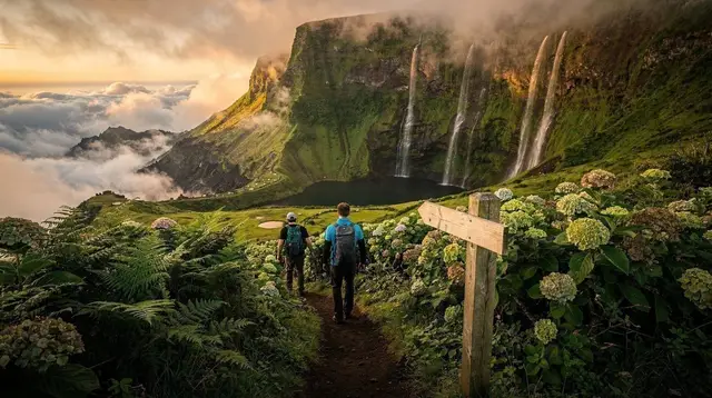
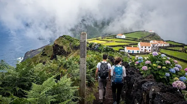
São Jorge’s north coast drops away in a wall of cliffs, and the only way down to the flat green shelves at their base is on your own two feet. If you have already decided São Jorge is your island and you are now trying to work out which descent to actually do, this is the practical version: real elevation numbers, how long each trail takes, and — the part most trip reports skip — how you get back up once you are down there.
Two hikes, two very different days out
The two trailheads that come up again and again when people plan a São Jorge fajã hike are the descent to Fajã da Caldeira de Santo Cristo and the descent from Serra do Topo to Fajã dos Vimes. They are both hikes down to a fajã, but they are not interchangeable, and choosing the wrong one for your fitness level or your remaining daylight is the single most common planning mistake on this island.
Fajã da Caldeira de Santo Cristo
This is the trail most visitors mean when they say “the fajã hike” on São Jorge. It leads down to a coastal lagoon separated from the Atlantic by a narrow gravel bar, an ecosystem locally famous for the clams (ameijoas) harvested in its shallow water. The trailhead sits inland and above, and from there the path drops in a fairly continuous, switchbacking descent to sea level.
Expect a real elevation loss in the order of 300 to 400 metres, covered over roughly 3 to 4 kilometres of path, in around 1 to 1.5 hours heading down at a steady pace. The surface alternates between packed earth, loose volcanic gravel, and short cobbled or stepped sections, and it is narrow enough in places that passing another hiker means stepping aside. None of this is technical climbing, but it is a sustained, knee-testing descent rather than a gentle walk, and it demands full attention the entire way — this is not a trail to do while chatting and looking at the view.
Once at the bottom, the lagoon and its handful of buildings make for an obvious, worthwhile stop: swimming in the lagoon, watching the surf break over the bar, or simply resting before the return. Whether that return is on foot or by boat is the single biggest decision to make before you set off, and it is covered in its own section below.
Fajã dos Vimes via Serra do Topo
The second classic route starts at Serra do Topo and descends to Fajã dos Vimes, a smaller, quieter settlement known locally for small-scale farming rather than for a lagoon. This descent is shorter and gentler than the Santo Cristo trail — typically 45 to 60 minutes each way — and the path, while still going steadily downhill, does not demand the same constant attention to footing.
That relative ease makes it a better choice for a family with older children, for hikers who want a fajã experience without dedicating an entire day to it, or as a warm-up before attempting Santo Cristo on a later day of the same trip. It is still, however, a one-way descent with a matching climb back out on the same path — there is no loop, no shortcut, and no vehicle access at either end.
The descent nobody mentions: elevation, terrain, and pace
It is worth being blunt about this because it is the detail most casually written guides leave out: these are not scenic strolls. A drop of 300 to 400 metres on foot, on loose or uneven ground, is a genuine hike by any standard, and the numbers matter more on the way back up than on the way down. Hikers who arrive at a fajã energised by the view down and underestimate the climb back are the ones who end up exhausted, dehydrated, or hiking the last stretch after dark.
A few concrete planning points:
- Budget close to double the descent time for the return climb on the same trail, since ascending a steep, loose surface is slower and more tiring than descending it.
- Fog and low cloud form quickly at altitude on São Jorge, sometimes within the hour, and can cut visibility on the upper sections of these trails sharply — check conditions before starting, not just the forecast for the coast.
- There is no shade for long stretches of either descent, so a midday start under full sun adds real heat load on top of the physical effort.
- Neither trail has water points along the way; anything you drink on the trail, you carry.
None of this means the hikes are unsuitable for a reasonably fit visitor — thousands of people do them every season — but they should be approached with the same respect you would give any steep, unassisted mountain descent, not treated as an extension of a beach walk.
Getting back up: on foot or by boat-taxi
This is the logistical question that actually shapes your day, and it plays out differently at each fajã.
At Fajã da Caldeira de Santo Cristo, locally run boat-taxis connect the lagoon area with Calheta on the coast when sea conditions allow, and this is how many hikers turn what would otherwise be a punishing there-and-back climb into a one-way walk down followed by a short, scenic boat ride out. These boats are informal, weather-dependent, and not bookable in advance from home — you confirm on the day, ideally by asking locally or through an operator running trips in the area, and you should always have the walking-back-up option in your plan B if the sea is too rough to run.
At Fajã dos Vimes, the shorter and gentler gradient means most hikers simply walk back up the way they came without needing an alternative, and the option of exiting by vehicle from the settlement (rather than by boat) is more commonly used here than a maritime pick-up.
The practical upshot: treat “descend and return on foot” as your default assumption for planning purposes at both fajãs, and treat a boat-taxi out of Santo Cristo as a bonus if conditions allow it on the day, not as something to build your whole itinerary around.
At a glance: comparing the two trails
| Fajã da Caldeira de Santo Cristo | Fajã dos Vimes (via Serra do Topo) | |
|---|---|---|
| Elevation loss | Roughly 300–400 m | Noticeably less, a gentler grade |
| Descent time | About 1–1.5 hours | About 45–60 minutes |
| Terrain | Loose gravel, packed earth, cobbled/stepped sections | Steadier downhill path, less technical footing |
| Return options | On foot, or boat-taxi to Calheta when conditions allow | On foot; vehicle access from the settlement is more common here |
| Highlight at the bottom | Coastal lagoon, clam beds, swimming | Small farming settlement, quieter atmosphere |
| Best suited to | Fit hikers with a full half-day free | Families, shorter visits, a first taste of a fajã descent |
Planning your day: how much time you actually need
For Fajã da Caldeira de Santo Cristo, budget a full half-day at minimum once you add driving to the trailhead, the descent, time at the lagoon, and either the climb back up or waiting on a boat-taxi. Starting in the morning gives you the best chance of calmer seas if you are hoping for a boat return, and leaves a comfortable margin if you end up walking back instead.
For Fajã dos Vimes, two to three hours round trip from the Serra do Topo trailhead is realistic for most hikers, which makes it easier to combine with other stops on São Jorge the same day — though even here, resist the temptation to also fit in Santo Cristo afterwards. Doing both descents properly, with real time to enjoy either fajã, is a two-day plan for most visitors, not one.
What to bring
Hiking boots with real ankle support and grip are non-negotiable on both trails; trail runners will do in dry conditions but sandals or casual shoes are a genuine hazard on the loose descent sections. Carry more water than you think you need, since there is nowhere to refill on the way down or up. A light rain shell is worth packing even under a clear morning sky, given how quickly weather changes at altitude here. Trekking poles help considerably on the steeper stretches of the Santo Cristo descent, particularly on the way back up.
Other fajã trails on São Jorge’s north coast
Santo Cristo and Vimes are the two most walked descents, but they sit among a wider network of paths dropping to smaller fajãs along São Jorge’s north coast, several of them linked by longer coastal trails for hikers who want a multi-day or multi-fajã itinerary rather than a single there-and-back outing. If a single descent leaves you wanting more, a guided multi-fajã or overnight itinerary is the better way to see additional ground safely than trying to string several independent descents together on your own in one day.
Booking a guided fajã hike
If you would rather not navigate trailhead logistics, boat-taxi availability, and fog calls on your own, a guided option takes the guesswork out of the day. The São Jorge fajã camping and hiking tour is built for hikers who want to spend a night down at a fajã rather than rushing the round trip in a single afternoon.
For a full day covering the island’s trail network rather than a single fajã, the full-day PR1 hiking route across São Jorge takes in a broader stretch of terrain with a guide managing pace and navigation.
Hikers specifically after the Serra do Topo descent can book the guided PR2 trail from Serra do Topo down to Fajã dos Vimes, which pairs well with a shorter visit to the island.
For a day that mixes driving, walking, and a boat leg without you having to arrange any of it yourself, the full-day São Jorge tour combining vehicle transfers with a boat trip is the closest match to the walk-down, boat-back pattern described above.
Fajã hikes on São Jorge: your questions answered
How hard is the hike to Fajã da Caldeira de Santo Cristo?
It is a steep, sustained descent of roughly 300 to 400 metres on a narrow path with loose volcanic soil and cobbled sections, usually taking 1 to 1.5 hours down. It is not technical, but knees and ankles feel every step, and the same path back up is a genuinely strenuous climb, not a stroll.
Can I avoid walking back up from the Caldeira de Santo Cristo lagoon?
Yes, locally arranged boat-taxis connect the Santo Cristo lagoon area with Calheta on the coast, which is how many hikers turn the trip into a one-way walk instead of an out-and-back climb. Boats are informal and weather-dependent, so confirm availability on the day rather than assuming a fixed schedule.
Is Fajã dos Vimes easier than Fajã da Caldeira de Santo Cristo?
Generally yes. The Serra do Topo trail down to Fajã dos Vimes covers a shorter distance and a gentler gradient, typically 45 to 60 minutes each way, though it is still a one-way descent on foot with a matching climb back out.
Can I hike to more than one fajã in a single day?
It is possible on paper but rarely comfortable in practice. Each descent-and-return already fills half a day once you count driving to the trailhead, the walk down, time at the fajã, and the climb back up, so stacking two full fajã hikes in one day usually means rushing both.
Do I need a guide for these trails?
The paths are generally well marked and walkable independently in good weather, but a guide adds real value on São Jorge because of fast-changing fog at altitude, loose footing on the descent, and local knowledge of whether a boat-taxi is running that day.
What should I wear for the fajã descents?
Proper hiking boots with ankle support and grip, not trail runners or sandals, because the descent surface is loose and often damp. Bring a light rain layer even on a clear morning, since São Jorge’s weather can shift within the hour.
Is there a shortcut or vehicle track down to the fajãs?
No. Both Fajã da Caldeira de Santo Cristo and Fajã dos Vimes are reached only on foot from their respective trailheads; there is no road, cable car, or shuttle down to the lagoon or the settlement itself.
If São Jorge is one stop on a longer trip, the island’s other trails, its cheese, and its place in a wider Azores itinerary are covered separately — see the São Jorge destination guide, the fajãs of São Jorge overview, and the three-day São Jorge itinerary for how these hikes fit around a full visit.
For background on what a fajã actually is geologically, see the explainer on fajãs, and for the archipelago-wide difficulty system referenced on trail signage, see the Azores trail grading guide rather than this page.
Base yourself near Velas or Calheta to keep drive times to either trailhead short, and check driving conditions in the Azores before an early start, since coastal roads can be affected by the same fog that settles on the trails. If São Jorge is part of an island-hopping route, inter-island ferry connections are worth checking well ahead, particularly outside the core summer months.
For the wider trail network beyond these two fajãs, browse the best hikes across the Azores, and pack according to the Azores packing list and the general travel safety guide, both of which apply directly to a day spent on steep, unassisted trails like these. Weather that can flip within the hour is not unique to São Jorge — see the month-by-month weather guide for how it plays out across the season — and for more guided and self-guided options by activity, browse the hiking trails category.
For the island’s other well-known product grown on these same fajã plateaus, the São Jorge cheese guide covers the cheese itself rather than the trails that lead to it.
tours.hiking-trails
Verified deep-linked GetYourGuide tours. Book through these links and we earn a small commission at no cost to you.
GetYourGuide does not provide a product photo for this activity — the image shows the meeting point, photographed by us.