São Jorge in 3 Days: A Fajã Hiking Itinerary
Three Days, One Ridge, and a Lot of Descending
São Jorge is a narrow spine of an island, and almost everything memorable about it sits below the ridge road, down at the fajãs — those flat green shelves where old lava flows or landslides pushed the coastline out into the Atlantic. Seeing them properly means walking down to them, which also means walking back up. This itinerary is built for exactly that trade: three days, one warm-up hike, and one serious descent-and-climb, based out of Velas and Calheta with a rental car linking the trailheads.
It is not a gentle plan. If you came to São Jorge expecting the soft crater walks of São Miguel, recalibrate now: the routes below are graded moderate to strenuous, they run on uneven stone and packed earth rather than boardwalk, and the return leg out of a fajã is, without exception, the hardest part of the day. For background on how Azorean trails are graded and what those grades actually mean underfoot, see our guide to how Azores trails are graded.
Before You Go: Fitness, Gear, and Timing
Budget realistically for this itinerary. A fit adult hiker with no joint problems and some experience of steep, sustained descents will manage it comfortably in three days. Someone whose hiking experience is mostly flat coastal paths should either add a rest day or scale back Day 2 to the boat-assisted version described further down.
Pack trekking poles if you use them; they make a genuine difference on the descent to Fajã da Caldeira de Santo Cristo, where loose volcanic gravel sits on top of old stone paving. Bring more water than feels necessary — there is no reliable source once you leave Serra do Topo — and cash, since neither fajã has a bank or a card machine. For a fuller kit list built for Azorean weather rather than a generic packing checklist, see our Azores packing list.
Base yourselves in Velas for Days 1 and 2 and consider shifting to Calheta for the final night if you are catching an early flight or ferry out. A rental car is close to essential here: both trailheads sit inland on the Serra do Topo ridge road, well away from the island’s thin public transport network. Pick the car up on arrival — see our notes on renting a car in the Azores — and expect narrow, winding roads with the occasional patch of fog on the ridge itself.
Most visitors reach São Jorge by SATA Air Açores from Ponta Delgada or Terceira; a smaller number arrive by ferry as part of the Pico–Faial–São Jorge “Triangle” crossing, which runs reliably in summer. If you are coming from Pico or Faial rather than flying in directly, our guide to inter-island ferries in the Azores covers the timetable pattern; if you are flying, see SATA’s inter-island flight network for how São Jorge connects to the rest of the archipelago.
Day 1 — Velas and a Warm-Up Descent to Fajã dos Vimes
Land in Velas, collect the rental car, and use the afternoon to settle in rather than launch straight into the island’s toughest trail. This itinerary treats Day 1 as acclimatisation: a shorter, gentler descent from the Serra do Topo trailhead down to Fajã dos Vimes, roughly two to three hours round trip depending on pace, dropping through laurel forest and pasture rather than the raw lava terrain of the north-coast routes.
Fajã dos Vimes itself is small and quiet, worked by a handful of families rather than set up for crowds, and it is a reasonable place to test your knees on a descent before committing to the far longer one tomorrow. Treat the return climb here as a rehearsal: note your pace, how your legs feel on the steeper sections, and how much water you actually drink, so you can calibrate Day 2 accordingly. For those who would rather do this stretch with a guide and a fixed schedule, the Mini Tour on Trail PR2 from Serra do Topo covers this exact route.
Drive back to Velas for the evening. Do not plan anything strenuous after the hike; an early dinner and an early night matter more here than they would on a beach-based itinerary, because tomorrow starts the real work.
Day 2 — Serra do Topo to Fajã da Caldeira de Santo Cristo
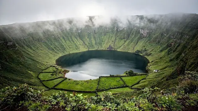
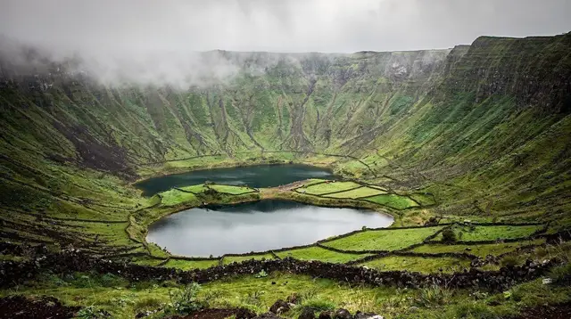
This is the day the whole itinerary is built around, and it deserves to be treated as such: start early, before the midday heat builds on the exposed upper section of the trail, and do not schedule anything else for the day. The PR1 route runs from the Serra do Topo trailhead down to Fajã da Caldeira de Santo Cristo, the lagoon fajã famous for its clam beds and its near-total isolation from road access. Do not mistake this for a scenic stroll: several hundred metres of altitude separate the ridge from the lagoon, the path alternates between stone steps, packed earth, and loose volcanic scree, and every metre lost on the way down has to be regained on the way back up, usually in the afternoon sun.
Give yourselves four to six hours for the full round trip, more if you plan to swim in the lagoon or linger over lunch at the small local café near the water. The descent itself typically takes ninety minutes to two hours at a comfortable pace; the return climb reliably takes longer than the descent, sometimes noticeably so, and this is exactly where an unprepared hiker’s day goes wrong. Watch the weather before committing: heavy rain makes the stone sections genuinely slick, and fog on the ridge can cut visibility to almost nothing at the trailhead.
There is one way to avoid the return climb altogether: on some days, a local boat transfer runs along the coast from the lagoon to Fajã dos Cubres, which does have road access, letting you finish the hike one-way instead of there-and-back. This depends entirely on sea conditions on the day and should never be assumed in advance — plan for the climb, and treat a successful boat transfer as a bonus.
If you would rather have a guide manage the logistics, timing, and any boat arrangement, the guided hike to Fajã da Caldeira de Santo Cristo is built around this exact route, or for a longer, fully supported day, the full-day PR1 hiking tour covers the same descent at a paced, guided speed.
| Route this itinerary uses | Trailhead | Destination fajã | Typical round trip | Character |
|---|---|---|---|---|
| PR2 (Day 1) | Serra do Topo | Fajã dos Vimes | 2–3 hours | Moderate, forested, a fair warm-up |
| PR1 (Day 2) | Serra do Topo | Fajã da Caldeira de Santo Cristo | 4–6 hours | Strenuous, exposed steps, steep return climb |
A small number of hikers turn Day 2 into an overnight instead of a day trip, camping near the lagoon and climbing back out the next morning rather than in the same afternoon. The fajã camping and hiking tour is built for exactly that version of the day, and it is worth considering if the idea of tackling that climb straight after the descent, in one push, does not appeal. If you take this option, shift this itinerary’s Day 3 back by one and adjust your onward travel accordingly.
Back in Velas for the night, expect tired legs rather than a light stroll along the harbour — plan dinner somewhere close to where you are staying.
Day 3 — Calheta, the Coast Road, and Departure
After two demanding days, Day 3 is deliberately lighter. Drive the coast road from Velas towards Calheta, stopping at viewpoints along the way rather than committing to another major descent. This is the day to let sore legs recover while still seeing more of the island: short walks around Calheta itself, a slower pace, and time to browse the small producers along the route.
If your legs and your schedule both allow it and you want one more taste of fajã terrain without repeating Day 2’s climb, the shorter PR2 route to Fajã dos Vimes can be walked from the Calheta side instead, or you can simply revisit sections of it at a gentler pace. For hikers who prefer wheels to boots on a recovery day, a guided option covering more ground with less physical strain is the short trail tour from Serra do Topo, kept deliberately brief.
Use the afternoon for departure logistics: whether you are flying out of Velas via SATA or catching a ferry back across to Faial or Pico as part of the Triangle crossing, build in slack, since inter-island connections in the Azores are not something to cut close on a hiking trip where fatigue slows everyone down. If your route home runs through Pico or Faial, our guide to a Pico–Faial day trip by ferry is useful for understanding how that crossing fits into a wider Azores itinerary.
Where to Sleep and What It Costs
This is a mid-range itinerary by design: comfortable guesthouses and small hotels in Velas and Calheta, a rental car for three days, and one or two guided components rather than a fully self-supported budget trip or a private-guide-every-day luxury version.
| Cost category | Typical range per person, per day |
|---|---|
| Mid-range guesthouse or small hotel | €50–€90 |
| Rental car (split across a couple) | €15–€25 |
| Meals, local restaurants | €25–€40 |
| One guided hike (Day 2, optional) | €45–€75 |
Treat the guided-hike figure as optional rather than fixed: hiking PR1 self-guided costs nothing beyond fuel for the car, but a guide adds real value on this particular trail, both for pacing the climb and for reading the lagoon’s tide and swell before anyone gets in the water.
Booking These Hikes: Guided or Self-Guided
PR1 and PR2 are both waymarked, and experienced hikers can walk either self-guided with a paper map or a downloaded GPS track. What a guide adds on São Jorge specifically is local judgement: knowing whether the boat transfer from the lagoon is running that day, reading changing weather on the exposed ridge sections, and pacing a group so the return climb does not become an emergency. First-time visitors, solo hikers, and anyone unsure of their own pace on a sustained climb should lean towards a guided option for Day 2 at minimum.
Book ahead rather than on arrival, particularly in July and August: guided slots on PR1 are limited, and turning up at Serra do Topo hoping to join a group is not a reliable plan. For a wider view of hiking options across the island beyond this specific three-day route, our best hikes in the Azores guide and our dedicated São Jorge fajã hikes guide both cover routes this itinerary does not, and the hiking trails category lists bookable options island by island.
For general trip-length planning beyond São Jorge, browse our other Azores itineraries, and check month-by-month conditions in our Azores weather guide before you fix your dates.
Frequently Asked Questions About This São Jorge Fajã Itinerary
Is this itinerary too hard for an average hiker?
It is built for someone with genuine hiking fitness, not a casual walker. The PR1 descent to Fajã da Caldeira de Santo Cristo loses several hundred metres of altitude on cobbled, sometimes wet stone paths, and every metre down on Day 2 has to be climbed again in the afternoon heat unless you arrange a boat pickup.
Can I really do São Jorge’s fajã hikes in only 3 days?
Yes, but 3 days covers one warm-up walk and one major descent-and-climb, not the whole island. This itinerary deliberately picks PR2 to Fajã dos Vimes as an easier first day and reserves the demanding PR1 route for Day 2, when you are acclimatised but still fresh.
Do I need a car on São Jorge for this route?
Yes. Both trailheads used in this itinerary, at Serra do Topo, sit inland on the island’s spine and are not served by useful public transport, so a rental car is effectively required to reach the start of each hike and to get back to Velas or Calheta afterwards.
Should I book a guided hike or go self-guided on PR1?
Both are workable: the trail is waymarked, but a guide adds local knowledge of the tide and swell at the lagoon, and can sometimes arrange the boat transfer back to Fajã dos Cubres so you skip the return climb. First-time visitors and anyone hiking alone should lean towards a guided option.
Is there a way to avoid climbing back up from Caldeira de Santo Cristo?
On some days, local operators run a boat transfer along the coast from the lagoon to Fajã dos Cubres, which has road access, cutting the return climb out entirely. This depends on sea conditions and is not guaranteed, so treat the climb back up as the default plan rather than an optional extra.
What should be in my daypack for these hikes?
Sturdy trail shoes with real grip, trekking poles for the descent, at least 1.5 litres of water per person, a rain shell even on a clear morning, and cash, since there are no shops or ATMs at either fajã.
Can weather cancel the PR1 descent?
Persistent rain turns the stone steps on the descent genuinely slippery and fog on the Serra do Topo ridge can remove visibility almost entirely, so it is worth keeping Day 3 as a buffer and swapping days if the forecast for Day 2 looks poor.
Is camping at the fajãs an option instead of a strict 3-day loop?
Yes, a small number of visitors extend this itinerary into an overnight at Fajã da Caldeira de Santo Cristo, sleeping near the lagoon and returning the next morning, which turns the tight 3-day version into a more relaxed 3-night one.
tours.3 days
Verified deep-linked GetYourGuide tours. Book through these links and we earn a small commission at no cost to you.
GetYourGuide does not provide a product photo for this activity — the image shows the meeting point, photographed by us.