What a Fajã Actually Is
The cliff collapse that started it all
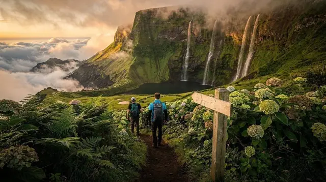
I’d read the word “fajã” a dozen times before I understood what it actually described. It kept turning up in the same sentence as São Jorge, always translated loosely as “lava platform” or “coastal shelf,” which is technically correct and still didn’t help me picture anything. Then I stood at the top of one of the crossings on São Jorge, looking down eight hundred metres of near-vertical basalt at a flat green tongue of land sitting right at the waterline, and it clicked immediately. A fajã is exactly what it looks like from up there: a piece of flat ground that has no business being at the base of a cliff that steep, and yet there it is.
There are two ways a fajã gets made, and once you know them you start reading the whole coastline differently.
The first is volcanic. Molten rock finds its way down a fissure or a slope, reaches the ocean, and keeps going until it cools and hardens into new land that simply wasn’t there before. That’s a lava fajã — ground manufactured on the spot, one eruption at a time.
The second is gravity, plain and simple. A slice of the cliff face, weakened by centuries of rain and wave action undercutting it, eventually gives way and slides downward. What lands at the bottom isn’t lava; it’s a jumbled mass of soil, rock, and whatever vegetation was growing on top, which settles over time into the same kind of flat shelf. That’s a landslide fajã, and it’s the more common of the two.
From the top of the cliff, or from a boat looking back at the coast, you genuinely can’t always tell which kind you’re looking at without knowing the local history. Both end up as the same striking shape: a strip of flat, cultivable, livable land wedged between an ocean and a wall of rock, usually connected to the rest of the island by nothing more than a footpath or a single narrow road.
Why São Jorge has so many
São Jorge’s whole geography seems built for this. The island is a long, narrow ridge with cliffs dropping almost straight to the sea on both sides, and that combination of volcanic activity and unstable, wave-battered basalt has produced somewhere around forty fajãs along its coastline — by far the highest concentration anywhere in the Azores. That’s the reason the word gets attached to the island so firmly that people sometimes assume it’s a São Jorge exclusive.
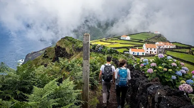
It isn’t, and I’d rather say that plainly now than let the rest of this article imply otherwise. The same geology — volcanic islands, tall sea cliffs, plenty of rain to destabilise them — exists across the archipelago, and fajãs turn up wherever those ingredients meet. Flores has its own, and one of them gave its name to an entire village: Fajã Grande, on the island’s western tip, sits on exactly this kind of shelf. São Jorge just has more of them, packed closer together, and a couple that have become genuinely famous.
Fajã da Caldeira de Santo Cristo: a lagoon with clams
The best known of all of them is Fajã da Caldeira de Santo Cristo, on São Jorge’s north coast. What sets it apart isn’t just the shelf itself but the shallow saltwater lagoon trapped behind a natural sandbar at its edge, home to a population of clams — ameijoas — found nowhere else in the Azores in quite this way. There’s no road in; it’s reached on foot, which is exactly why I’m not going to walk you through the route here. If that’s what brought you to this page, the trail-by-trail detail lives in a proper hiking guide, not in an explainer about what the landform is in the first place.
What I will say is that the fajã has a handful of places to eat and sleep despite its isolation, and that the walk in and out is treated by most visitors as the whole point of the day, not an inconvenience on the way to it.
Fajã dos Vimes: the one you can actually drive to
If Santo Cristo is the fajã people photograph, Fajã dos Vimes is the one that’s easiest to simply visit. It has year-round road access, which most of São Jorge’s fajãs don’t, and a small community that has stayed put because of it. What surprised me most here was a working coffee plantation — genuinely unusual planted this far north — tucked into a shelf of land that, geologically speaking, exists for the same reason as every other fajã on the island: rock came down from above and settled into flat ground below.
It’s a good stop if you want to understand the phenomenon without committing to a hike, and a natural companion to a slower loop through São Jorge’s coastal villages like Velas or Calheta.
What I’d tell you before you go looking for one
A few things I wish someone had told me before I started chasing fajãs on a map.
| Fajã | Island | Access | What makes it distinct |
|---|---|---|---|
| Fajã da Caldeira de Santo Cristo | São Jorge | On foot only | Saltwater lagoon, clam beds |
| Fajã dos Vimes | São Jorge | Road, year-round | Resident community, coffee plantation |
| Fajã Grande | Flores | Road, year-round | Grown into a full village |
Don’t treat “fajã” as a São Jorge trademark. It’s a geological term first and a São Jorge specialty second — the island simply has the terrain and the erosion history to produce far more of them than anywhere else. If you’re island-hopping and only have time for one island’s fajãs, São Jorge is still the obvious choice for sheer numbers, but don’t be surprised when the word shows up again on Flores.
Also don’t assume every fajã is remote and roadless. Some, like Fajã dos Vimes, are as easy to reach as any coastal village. Others take a genuine hike to reach, and a few of São Jorge’s smallest are essentially day-trip-only, visited by boat rather than on foot.
And don’t confuse the fajãs with the island’s other volcanic features. São Jorge’s fajãs are a coastal phenomenon; the archipelago’s craters, calderas, and lava tubes covered in our wider guide to the Azores’ volcanic landscape are a different, if related, story. If you want the fuller geological picture of how these islands were built — the same forces that raised Pico to 2,351 metres — that guide, and our Azores Geopark guide, are the better next stop than this one.
Where this leads next
I’ve deliberately kept this piece to the “what and why” rather than the “how to get there.” If you want the actual trail notes — distances, elevation, which fajãs connect to each other on foot — that’s covered properly in our São Jorge fajãs hiking guide, which is written for people who already know what they’re walking toward. The same goes for Flores: the trails around Fajã Grande and the rest of the island are laid out in our Flores hiking guide, and a wider shortlist of routes across the whole archipelago sits in our best hikes in the Azores roundup.
If a taste of São Jorge while you’re there matters to you as much as the geology does, it’s worth knowing the island’s fajãs and its famous cured cheese come from the same volcanic soil and damp, green pastures — there’s a whole side story in our São Jorge cheese guide if you want it.
And if fajãs are the thing that finally convinces you the Azores’ volcanic story is worth chasing further, the vineyards planted straight into old lava on neighbouring Pico — covered in our Pico wine and UNESCO vineyards guide — are the next chapter, and climbing Mount Pico itself puts the whole archipelago’s geology under your feet at once.
Most of my own island-hopping starts and ends through Ponta Delgada on São Miguel, and if you’re passing through there between islands, a short excursion is an easy way to fill a spare day. I’ve done the crater lakes on a half-day Sete Cidades tour and the volcanic lake at Lagoa do Fogo on a half-day trip, both of which scratch the same “how did this land actually form” itch that got me into fajãs in the first place.
If you have a full day to spare, the full-day Nordeste excursion covers some of São Miguel’s least-visited coastline, which is where I’d point anyone who already loves the idea of land shaped by collapse and eruption rather than by anything gentler.
None of that replaces actually walking a fajã. But it’s a reasonable way to spend the days on São Miguel while you wait for a ferry or a flight to São Jorge, and it kept me content the first time weather pushed my own fajã hike back by two days.
tours.hiking-trails
Verified deep-linked GetYourGuide tours. Book through these links and we earn a small commission at no cost to you.
GetYourGuide does not provide a product photo for this activity — the image shows the meeting point, photographed by us.