Where Faial’s Land Runs Out
Drive to the far western tip of Faial and the island simply stops behaving like the rest of the Azores. The pastures, hydrangea hedges, and dairy cattle that define most of Faial give way, over the space of a few hundred metres, to a flat, grey, almost lunar apron of compacted ash that slopes down into the Atlantic. This is Capelinhos: not a crater you climb into, like the Caldeira at the island’s centre, but a headland that did not exist before the middle of the twentieth century. It is one of the youngest pieces of land in Europe, and it is also, unmistakably, a graveyard for the lighthouse that used to mark this coast for passing ships.
This page is about that promontory specifically — what happened here, why the landscape looks the way it does, and how a place this compact and specific fits into a broader day exploring the island. It is not a substitute for the practical logistics of visiting: opening hours, ticket prices, and trail options for the site change with the season and are covered in full in the dedicated Capelinhos volcano guide. What follows is the context worth having before you decide how long to give it.
The Eruption That Built New Ground (1957-58)
Capelinhos exists because of an eruption that began offshore, not on land. In September 1957, a submarine vent off Faial’s western coast started throwing up ash, steam, and eventually enough volcanic material to build a new islet in the sea, which fishermen and islanders watched grow and shrink over the following weeks as the ocean fought the new cone. Within a few months, the eruption had produced enough material to connect that fledgling islet to Faial itself, extending the island’s coastline outward and permanently redrawing its western tip.
The eruption did not stop there. It continued, in phases of varying intensity, through the winter of 1957 into 1958, sending ashfall over a wide area of western Faial and forcing evacuations of nearby villages as roofs collapsed under the weight of falling ash and the local economy — largely agricultural — was smothered under a thick grey blanket. By the time the eruption finally ended in October 1958, it had buried farmland, displaced families (a wave of Azorean emigration to the United States is directly linked to the hardship this eruption caused), and left behind the flat, ash-covered plain that visitors walk across today.
It is worth being precise about the timeline here, because it is easy for a first-time visitor to misjudge how recent — or how current — this event is. The eruption is closer in time to the moon landing than to today; it is a well-documented twentieth-century event with photographs, newsreel footage, and firsthand accounts, not an ancient or a live hazard. The volcano is not dormant in the sense of “could erupt again at any moment during your visit” — there is no active seismic or eruptive activity here now, and the site is developed, signposted, and visited by thousands of people every year without incident. The story of Capelinhos is a story about what already happened, not about something ongoing.
A Lighthouse Swallowed by Ash
Before 1957, this stretch of coast was marked by the Farol dos Capelinhos, a working lighthouse built decades earlier to guide ships around Faial’s exposed western point. When the eruption began sending ash inland, the lighthouse did not collapse — it was buried. Ash piled up around its base and against its lower floors over the following months, in some places nearly reaching the height of the lantern room, turning a functioning piece of maritime infrastructure into something closer to a fossil half-submerged in its own surroundings.
That half-buried structure is still there, and it is the single most photographed subject at the site. Decades after the eruption, the lighthouse’s base — the parts that were most deeply packed with hardened volcanic ash — was excavated and converted into an interpretation centre, built partly underground and around the original structure, so that visitors walk past sections of ash-choked stonework on their way through exhibits about the eruption. The tower itself still stands above ground, scoured and weathered, looking out over the plain it helped create. Seeing it in person is the clearest way to grasp the physical scale of what fell here in 1957 and 1958 — photographs rarely convey just how much material buried a structure this size.
A Grey, Lunar Landscape on a Green Island
The Azores as a whole are famously, almost aggressively green — a function of Atlantic humidity and volcanic soil that produces the pastures and crater lakes visitors associate with islands like São Jorge or the interior of São Miguel. Capelinhos is the deliberate exception, and that contrast is exactly what makes it worth a stop. The ash plain here has had less than seventy years to develop soil and vegetation, compared with the centuries or millennia behind most of the archipelago’s landscapes, so much of it remains a stark expanse of grey and rust-coloured volcanic material, scattered with hardy pioneer plants just beginning to take hold.
Walking out toward the headland, the light does most of the storytelling: overcast days flatten the ash into a monochrome plain that some visitors describe as looking more like a desert or a lunar surface than anything else in the Azores, while low sun — early morning or late afternoon — picks out ripples and colour variation in the ash that are invisible at midday. The cliffs where the new land meets the Atlantic are abrupt and largely unvegetated, a visible edge between what existed before 1957 and what the eruption added. It is a landscape that rewards slowing down rather than a quick photo from the car park, even on a site that, by Azorean standards, does not take long to see.
Part of a Living Volcanic Chain
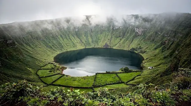
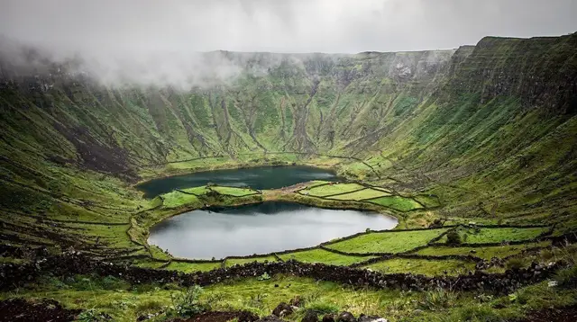
Capelinhos is not an isolated curiosity — it is one visible expression of the volcanic system that built the entire archipelago. The Azores sit on the junction of three tectonic plates, and that geological setting is what produces the archipelago’s hot springs, lava caves, and crater lakes across the nine islands, cataloged more broadly in the guide to Azores volcanoes and craters. Faial’s own volcanic record includes both the ancient, forested Caldeira at its centre and this much younger eruption at its edge, which makes the island a useful single-place lesson in how differently the same underlying process can look depending on when it happened.
The site also sits within the wider Geoparc Açores network, the archipelago-wide UNESCO Global Geopark designation that recognises sites of particular geological significance across all nine islands — a scientific framework that has helped fund the research station and interpretation work at Capelinhos, and one reason the site is treated as heritage rather than simply a scenic overlook.
Fitting Capelinhos Into a Day on Faial
Most visitors reach Capelinhos as part of a loop around Faial rather than as a destination in isolation, and it is worth thinking about the site that way. Faial is compact enough to circle in a day by car, and Capelinhos naturally anchors the western half of that loop, typically paired with a stop in Horta for its marina, its painted seawall murals, and lunch near Peter Café Sport, and often with a detour up into the Caldeira if time and weather allow — the crater and the volcano make a deliberate before-and-after pairing of the island’s volcanic history.
a guided car tour of Faial is a straightforward way to link Capelinhos with the Caldeira and Horta in a single day without worrying about navigation on the island’s narrower coastal roads, and it suits travelers who would rather listen to context along the way than piece the history together on their own. For a more active version of the same idea, a guided eco tour tends to spend more time on foot around the ash plain and the coastline rather than moving quickly between stops.
Travelers basing themselves on Pico rather than Faial, or splitting time between the two, can treat Capelinhos as the western Faial half-day of a broader two-island trip; the ferry from Madalena to Horta covered in the guide to Pico-Faial day trips by ferry and in the wider inter-island ferries guide makes this an easy add-on rather than a separate expedition, and the five-day itinerary combining Pico and Faial builds in a full day for exactly this kind of loop.
For visitors who would rather not drive at all, a full-day island tour departing from Horta covers Capelinhos alongside the rest of Faial’s highlights in one organised outing, and the broader spread of things to do on Faial gives a fuller sense of how the volcano fits alongside the island’s whale-watching, diving, and hiking options.
Best Light, Best Angles: Capelinhos for Photographers
Because the appeal of Capelinhos is almost entirely visual — texture, colour, and the scale of the buried lighthouse — timing a visit around light is worth more here than at most Azorean sites. Midday sun tends to flatten the ash plain into a uniform grey, while the lower-angle light of morning or late afternoon brings out ridges, colour bands, and shadow that make the landscape read as genuinely otherworldly in photographs. Overcast days are not a loss here the way they might be for a hike or a boat trip: flat light suits the site’s minimal, monochrome character and can make the lighthouse tower stand out even more starkly against the sky.
The most photographed vantage points are the paths leading out from the interpretation centre toward the headland and the cliffs where the ash plain meets the Atlantic, both of which put the lighthouse tower into the frame at a distance rather than directly underfoot. Wider context and more location-specific framing advice for this and other Azorean landscapes are gathered in the guide to photography spots across the Azores.
Getting to Capelinhos
Capelinhos sits at the far western end of Faial, roughly 20-25 minutes by car from Horta along the island’s main coastal road. There is no public transport network built around visiting the site directly, so a rental car remains the simplest way to combine Capelinhos with the rest of western Faial in one trip — general guidance on renting and driving on the island is covered in the Azores car rental guide. Travelers without a rental car generally rely on one of the guided tours above, all of which include Capelinhos as a stop rather than requiring it to be booked separately.
For a different vantage point altogether, several boat operators run trips along Faial’s coastline that pass directly beneath the Capelinhos cliffs from the water, showing the ash-cliff meeting the Atlantic from an angle the land-based paths cannot match. a boat tour to the Capelinhos natural monument is built specifically around this stretch of coastline, and it is a reasonable option for visitors who have already walked the site on land and want to see it once more from the water, or who would simply rather experience it that way from the start.
Faial’s waters are also one of the archipelago’s reliable bases for whale and dolphin watching, and several operators combine a Capelinhos-facing route with time spent looking for resident species further offshore; a whale and dolphin watching cruise from Horta is one way to fold that into the same day without a strict guarantee of sightings on any given outing, since wildlife encounters here are never certain.
Capelinhos at a Glance
| What | Detail |
|---|---|
| Location | Western tip of Faial, ~17 km / 20-25 min drive from Horta |
| Eruption dates | September 1957 – October 1958 (submarine, then subaerial) |
| Landmark | Farol dos Capelinhos (lighthouse), partly buried under hardened ash |
| Landscape | Flat ash plain and cliffs, minimal vegetation, grey and rust tones |
| Typical time on-site | 1.5–3 hours, longer for photography |
| Best paired with | Horta marina, the Caldeira, a Faial west-coast loop |
| Current status | Inactive since 1958; protected heritage and geopark site, safe to visit |
Capelinhos Volcano: Frequently Asked Questions
Is the Capelinhos volcano still active?
No. The eruption that created the site ran from September 1957 to October 1958 and has been over for decades. Capelinhos today is dormant and poses no volcanic risk to visitors; it is a protected landscape and heritage site, not an active hazard.
Can you still see the buried lighthouse?
Yes. The Farol dos Capelinhos still stands, though its lower floors remain packed with hardened ash from the eruption. Its base now houses an interpretation centre built into the structure, and the tower itself is one of the most photographed sights on Faial.
Is Capelinhos on Faial or on Pico?
Capelinhos is on Faial, at the island’s western tip, not on neighbouring Pico. The two islands sit close together across the Faial-Pico channel and are often visited on the same trip, but the volcano itself belongs to Faial.
How does Capelinhos differ from the Caldeira on Faial?
The Caldeira is the large, forested crater at the summit of Faial, formed over a much longer volcanic history. Capelinhos is a single, recent eruption site at sea level on the coast, and the two make a deliberate contrast: one green and ancient-looking, the other grey and newly made.
How much time should I set aside for Capelinhos?
Most visitors spend a couple of hours at the site itself, including the interpretation centre and a walk toward the headland, though exact trails and opening hours are covered separately. Combined with the drive from Horta and nearby stops on western Faial, budgeting half a day is realistic.
Is Capelinhos worth visiting if I only have one day on Faial?
For most travelers, yes: it is one of the island’s signature sights and a relatively quick stop compared with a full crater hike. On a single-day visit it pairs naturally with Horta’s marina and a short loop of the island’s west coast.
Can I see Capelinhos from the water rather than on land?
Yes, boat trips along Faial’s coast pass beneath the Capelinhos headland and give a different angle on the ash cliffs meeting the Atlantic, which many visitors find just as striking as the land-based viewpoint.